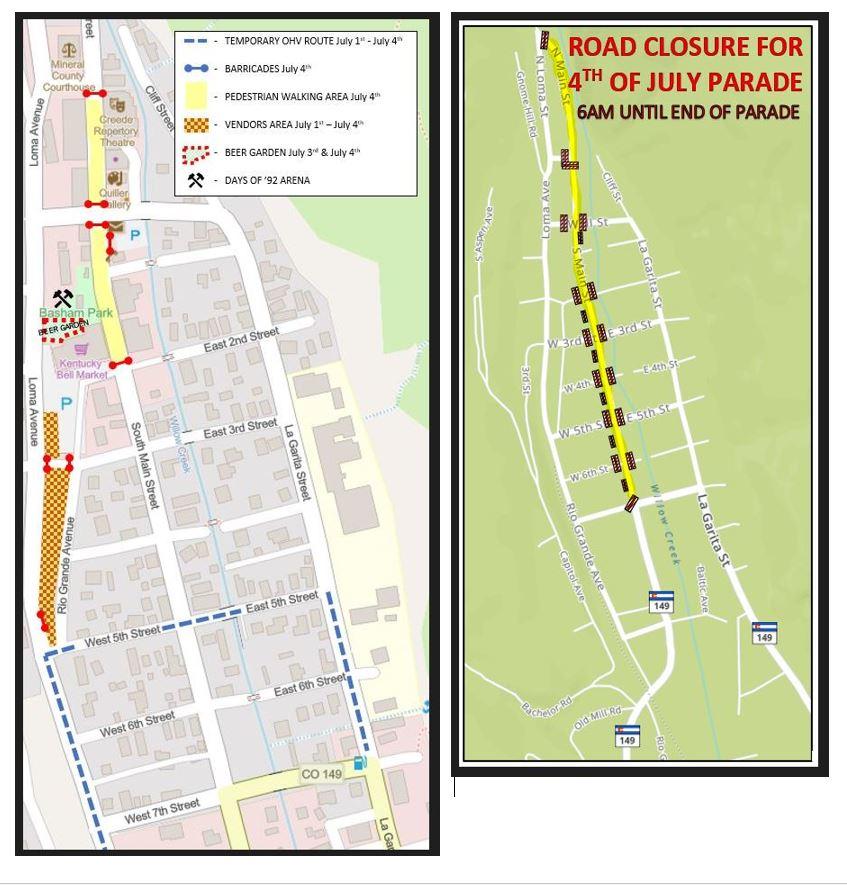
The first map (left) shows the locations of the different event locations that are happening over the weekend, as well as the OHV detouring onto 5th Street. The barricades shown on Main Street are the locations AFTER the parade is over on Monday 7/4. North Main Street will be barricaded from North 1st Street (at the courthouse) down to Wall Street., and from Wall Street down South Main Street to East 2nd Street. The Public Works Dept. will remove the barricades at approximately 5:00 pm.
The second Barricades map (right) shows where all of the barricades will be located at the start of the parade at 10:00 am. PLEASE NOTE that the barricades on Main Street at the intersections with Wall Street, 3rd, and 5th Streets will be placed so that these side streets can cross at the Main Street intersections up until 9:45 am to aid in the traffic flow prior to the parade. These barricades will be placed at these locations by the Public Works Dept. at approximately 6:00 am on Monday July 4th. The Public Works Dept. will remove the said barricades after the completion of the parade (except in the business district as stated above).
Click HERE to download or print PDF of Maps.
Have a wonderful and safe 4th of July Holiday weekend!